5/16-5/17 - Bald Head Island sits on the northeastern shore at the mouth of the Cape Fear River’s inlet to the ocean. It is accessible only by water. In spite of a push for major development in the 1960’s (which was somewhat thwarted) it has retained much of its unspoiled beaches, marshland and interior forests. There are many expansive home sites, cottages and condos, but they seem to blend in well with their natural surroundings. The streets are narrow and the mode of transportation is by electric golf cart. The marina was nice, but susceptible to quite a surge from the ocean inlet. As luck would have it, the dockmaster had mistakenly assigned us to a slip at the far end of the marina where the surge was not as bad. This area had smaller docks, but we were able to get in okay and tie off the bow of the boat along the short dock and the stern to the pilings. We seemed to ride the surge better here than the boats along the longer docks that were closer to the marina’s entrance channel.
We rented a golf cart and explored the island including Old Baldy Lighthouse, many beaches and the nature preserve. As part of our dockage, we were given a $20 coupon to the restaurant by the marina, Ed and Flo’s, so we happily used it for lunch one day. The weather was a little unsettled while we were here, but the only mishap was Linda getting caught in a downpour during a morning walk. All in all, it was a relaxing 2 days.
 |
| Entrance to the Bald Head Island Marina |
 |
Once checked into the marina, we wasted no time renting a golf cart.
It's the major form of transportation on the Island. |
 |
With map in hand, we went exploring. All of the beaches are
public and there are many beach access points.
This one had several long tubes extending out into the ocean.
They were geotextile tubes used for island reclamation and
shoreline protection. |
 |
| We visited Old Baldy (the lighthouse, not Gerry) |
 |
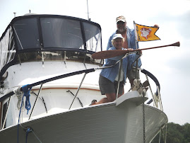
Here at the entrance Gerry is looking pretty happy.
That was before the 180 steps he had to climb |
 |
| This and the next 3 shots are views from the top |
 |
The wind and waves picked up at night.
A shot of one of the piers with water washing
through the boards |
 |
| The full moon rising over the Island |
 |
| Threatening skies in the morning |
 |
| Sun trying to peak through |
 |
Linda headed out for a walk (stinkin' weather
won't stop her) |
 |
| Two houses along the way with dark clouds building overhead |
 |
Things were looking pretty threatening by the time I reached
the beach. Watched a boat heading out (storm hit 5 minutes later
so I doubt they made it across to the ICW before getting blasted
by the wind and rain). |
 |
Looking this direction, things didn't seem so bad,
as there was a bit of clear sky |
 |
| Oh oh, pretty dark clouds --- should I head back???? |
 |
Too late -- wind and rain came and within seconds,
I was drenched. |
 |
A few hours later, it was beautiful -- here we're
exploring the Cape Fear Frying Pan Shoals area.
Sandbars stretch out for 20 miles into the ocean
and have been responsible for frequent shipwrecks,
making it part of the reason for the "Cape Fear" name. |
 |
| A large part of the Island is a nature preserve |
 |
Although this is part of nature, they were kind of creepy --
hundreds of little crabs scurrying everywhere |
 |
| Interesting trees |
 |
| Overlooking the marsh |
 |
| Flowering cactus |
 |
| Live oak tree with hanging moss |
 |
| They have bins for oyster shell recycling here on the Island |
 |
| ... and maybe also for a beer bottle or two |
 |
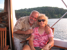
| We enjoyed lunch at Eb and Flo's overlooking the harbor |


No comments:
Post a Comment